Day 6: Craigie
- chris2429
- Nov 20, 2022
- 2 min read
Updated: Feb 12, 2023
20/11/22 - Distance: 31km

I left Camp at 630am after a very windy night with a storm rolling thorugh. It was again another slow progressive hill for most of the morning through logged forest roads with many bare hillsides. As I progress forward it becomes more evident the route as when I look back they way I came I can see the break through the mountains of which I had walked the previous day, avoiding an otherwise hilly and ruggered route. Once out of the state forests it opened up to beautiful gently rolling hills with high mountains in the back drop. This is now sheep and cattle country. I cut across to Mila Rd to get to Craigie. I spoke with a local sheep farmer in his 70s and he had worked with aboriginal people in the area in the past for forestry and other agencies and he talked of a route they used to follow that went much further north of here to the ranges where there was another major camping spot, potnetially they followed the Towamba River up toward Cathcart. He had a beautiful working Border collie and a trainee kelpie puppy and two dachhound watch dogs, one sitting on his lap. After a good 20min yarn I was off again along old country roads.
Lots of food plants along side of road from weedy mustard weed to native bulbine (an old aboriginal food of the area) plenty of orchids about again. Before Mila I deviated to a Travelling Stock Reserve which was at an old aboriginal camp and yam site. Lots of wombat holes and a few scar trees. No yam daisys, just dandelions and catsears. But the site gives you an idea of what it may have been like, im sure the surrounding plains would have been lovely open woodlands in the past. I continue on to Craigie on the lovely Little plains river famous for its large population of platypus. Unfortunately, I didnt end up seeing any. I the distance I see rain coming in fast so quickly fumble into my bag to get my wet weather gear on and just in time. I copped a drenching for a good 30mins with icy winds and loud thunder. I arrive at the local community hall in Craigie around 4pm and setup camp.
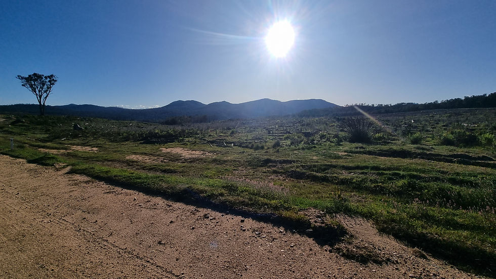
White Rock Mountains - My route came around the base of them from the right, between these mountains and Nungutta Mountain (another ruggered mountain which if further to the right and blocked by the hill.)

Scar Tree in the TSR


Old Yam daisy farm site on an old Travelling Stock Reserve


^ Bulbine bulbosa - edible tubers.


That hill is all covered in Radiata pine plantations (Pinus radiata)

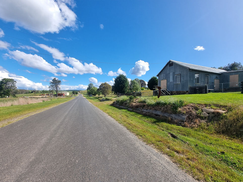
Craigie Hall


Comments